Explore landmarks.im
The Great Walllandmarks.im

Home · Named stretches

Places, not the whole line

Named stretches

These are real, named places on Ming-period wall. They are not a tour of every section, and the schematic below is not a map of one continuous wall.

That statement says the Great Wall begins in the east at Shanhaiguan in Hebei province and ends at Jiayuguan in Gansu province to the west. [UNESCO]

The most extensive and best-preserved version, Britannica says, dates from the Ming dynasty (1368–1644) and runs for some 5,500 miles (8,850 km) east to west from Mount Hu near Dandong, in southeastern Liaoning province, to Jiayu Pass west of Jiuquan, in northwestern Gansu province. [Britannica]

Traditionally, Britannica says, the eastern terminus of the wall was considered to be Shanhai Pass (Shanhaiguan) in eastern Hebei, on the coast of the Bo Hai; later government-sponsored investigations revealed sections of wall in Liaoning, and the greater total length of the Ming wall was announced in 2009. [Britannica]

A schematic of four named stretches, west to east, not to scaleJiayu Pass in the west, then a broken line, Mutianyu and Huanghuacheng near Beijing, then Shanhaiguan and the sea in the east. The gaps are deliberate: this is not a map of one continuous wall.WestEastJiayu PassGansuMutianyuHuanghuachengShanhaiguanthe sea
Our own schematic, west to the left and east to the right, not to scale and not a map. The dashed gaps are deliberate. These are named stretches, not a single continuous wall, and many other sections are omitted.

Shanhaiguan and the sea

UNESCO’s statement gives Shanhaiguan, in Hebei, as the eastern beginning of the wall it describes. Britannica notes that this was the traditional eastern terminus, and that later investigations also found wall farther east in Liaoning.
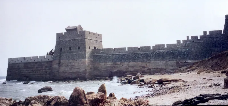
A stone fortress and crenellated wall standing in the surf, with a rocky beach in the foreground and a pale sky
The Old Dragon’s Head at Shanhaiguan, where this stretch of wall meets the sea, photographed in 1995.Photo: Prince Roy · CC BY 2.0
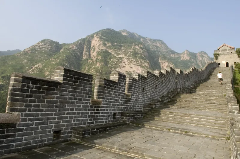
A steep grey brick stairway on top of the wall, with crenellations on the left, a roofed tower ahead, and green mountains beyond
The walkway of the wall at Shanhaiguan, Hebei, on 7 July 2006, looking toward the hills.Photo: Daniel Ng · CC BY 2.0

Huanghuacheng and Mutianyu

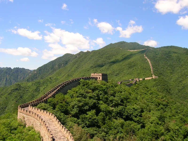
North and northeast of Beijing are several well-known Ming stretches. The winter photographs on this site are of Huanghuacheng, where the wall runs above a reservoir. The summer photographs are of Mutianyu. We do not have a sourced official length for either stretch alone, so we do not invent one.
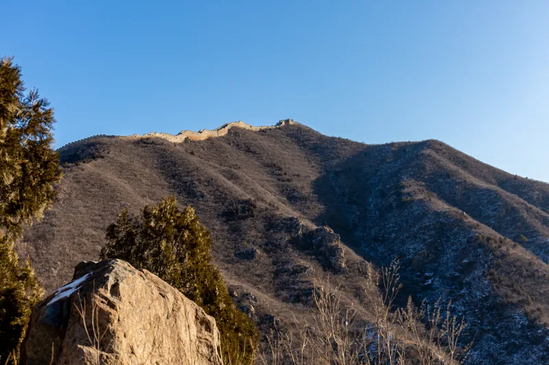
A hillside of bare winter trees, with a stone wall and two watchtowers along the ridge against a clear blue sky
The same Huanghuacheng stretch seen from below on 8 January 2020, with the wall riding the crest of the hill.Photo: Balon Greyjoy · CC0 1.0
A brick wall with crenellations and a square watchtower curving through densely wooded green hills under a blue sky with white clouds
The Mutianyu section, northeast of Beijing, in July 2006, with the wall and a watchtower running through green woodland.Photo: Velatrix · CC0 1.0
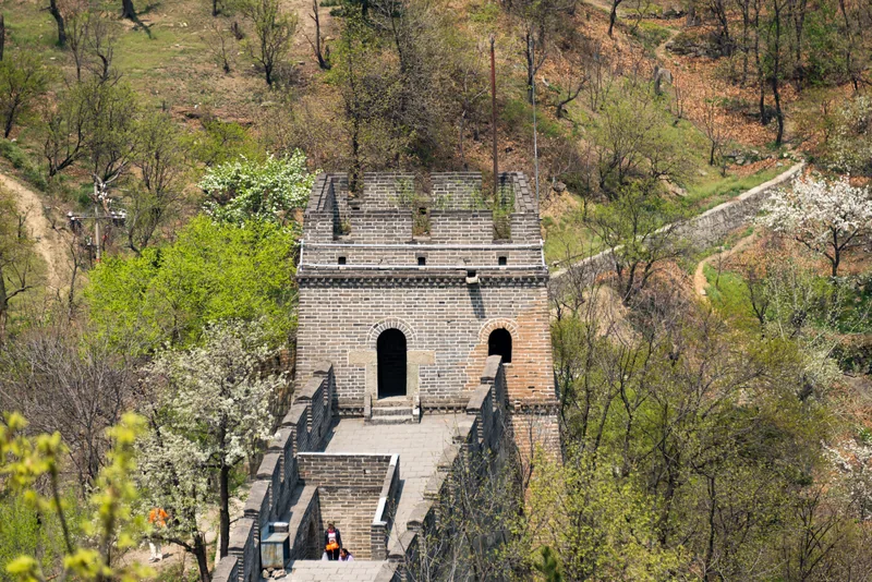
A grey brick watchtower with two dark arched doorways, seen from the wall walk, with blossoming trees on the slopes below
A brick watchtower on the Mutianyu section, 3 May 2013, with spring trees on either side of the walkway.Photo: xiquinhosilva · CC BY 2.0

Jiayu Pass

UNESCO’s statement gives Jiayuguan, in Gansu, as the western end of the wall it describes. Britannica’s Ming line ends at Jiayu Pass, west of Jiuquan in northwestern Gansu.
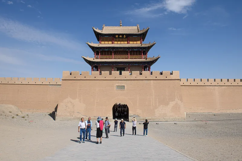
A three-storey traditional Chinese gatetower of packed earth and timber, with a rammed-earth wall and gateway, and visitors on the path in front
The gatetower of the fortress at Jiayu Pass, Gansu, on 19 September 2023. UNESCO’s Outstanding Universal Value text gives Jiayuguan as the western end of the wall it describes.Photo: N509FZ · CC BY-SA 4.0

Badaling, briefly

UNESCO records that the visual integrity of the Wall at Badaling has been impacted negatively by construction of tourist facilities and a cable car. [UNESCO]

We do not have a kit-safe photograph of Badaling on this site, so this page does not pretend to show it. The UNESCO note is about tourism and visual integrity, not a reason to skip the stretch; it is a reason to be careful about what a photograph of a busy pass is asked to stand for.

Sources on this page